


Giubin (2776m)23.05.2026
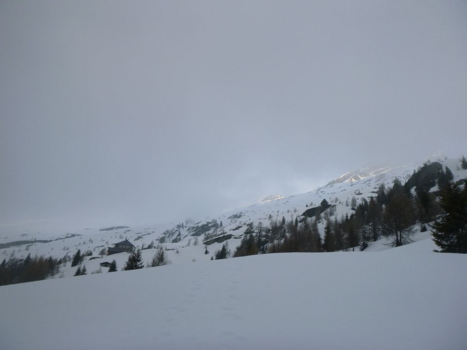
Tourenbeginn um 03:15 Uhr bei 4°C unter Vollmond und mit Stirnlampe. Ab Calle die Schneeschuhe angeschnallt. Nur noch Reste einer Skispur von vor 5 Tagen danach an manchen Stellen erkennbar. Wir orientierten uns nach der Sommerroute durch den Wald. Der Schnee war wegen den Temperaturen in letzter Zeit nicht gefroren, wir sanken jedoch nicht tief ein mit den Schneeschuhen. Nur sind immer wieder mal kurze Stellen im Wald schneefrei bis P 1537. Am Vormittag zogen dann ungemütliche Nebel- und Grieselschnee-Wolken auf. Zeitweise mit geringem Schneefall. Ebenso nahmen Windböen zu. Ab Rif. Sponda spurten wir dann am Vormittag hinauf in Richtung Gletscherpass über die Sommerroute SAC-Nr. 1236. Die SW-Flanke ab ca. 2600 m war jedoch aufgrund der Wärmestrahlung etwas angefirnt, so dass die Schneeschuhe nicht mehr hielten. Etwas akrobatisch wechselten wir dann in unterer Flanke auf Steigeisen um. Die Lichtverhältnisse waren diffus, der Wind wurde stärker und es begann Grieselschauer, so dass wir uns entschieden, rechts und etwas oberhalb vom Pass zum anfänglichen Grat aufzusteigen, um zurück zum Passo di Ghiacciaone dann nicht ganz so steil absteigen zu müssen. Wir trauten der Wetterprognose nicht. Im Abstieg kam dann allerdings tatsächlich die Sonne durch und es gab Sicht. Falsche Entscheidung ?
Das Gebiet wird bestimmt nicht von vielen Wintertouren-Gängern benutzt. Auf- und Abstieg zur / von der im Winter offenen Hütte ist lang und führt höhenintensiv durch den Wald, womit Schneeschuhgänger sicherlich besser zurechtkommen. Skitourengänger haben allerdings in den steilen freien Flanken am Berg ihre Vorteile, wo wir Ss-Gänger dann entweder mehr Zeit brauchen, auf Steigeisen umsteigen müssen, oder gar die Segel streichen.
Nach meiner Tour am 30.10.2017 (siehe Gipfelbuch-Eintrag zum Passo di Ghiacciaone) wieder hier und (leider) mal wieder nur zum Gletscherpass (und nicht bis zum Gipfel).
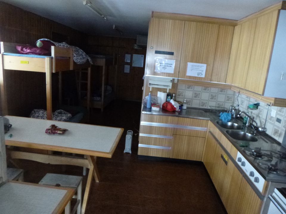
Im Rifugio Sponda machten wir morgens nach unserem nächtlichen Aufstieg 3 Stunden Pause. Wir setzten den Holzofen in Betrieb und erzeugten Heißwasser. Laut Hüttenbuch waren wir erst 8. und 9. Besucher der Hütte in diesem Jahr. Die Getränkevorräte bestehen im Rifugio allerdings nur noch aus einer Handvoll Cola-Dosen und Sprite-Flaschen. Wir hatten jedoch unsere Verpflegungssachen unabhängig davon dabei, bis auf Wasser. Wichtig war und ist auf der Hütte darum, das funktionierende Wasser im Dusch-u. WC-Räumchen (ansonsten ist Schneeschmelzen angesagt), ein kleiner Holzofen, der ausgezeichnet zieht, sowie super trockenes Feuerholz unterm Dach neben der Eingangstür. Die vierflammige Propangas-Kochplatte ist jedoch nicht betriebsbereit, weil der vorgeschaltete Münz-Gaszähler den Gasfluß nicht frei gibt. Womöglich ist dieser verstopft von den vielen 20-Rappen-Münzen (laut Gehäuseaufschrift), oder 20-Ct-Münzen laut Aufkleber ? Die oberste 20-Ct-Münze ist von mir. Mein 20-Rp-Münzchen für 2. Versuch ließ ich dann lieber sein. Als Verbesserungsvorschlag für den SAT rege ich an, diesen Zähler bei nächster Gelegenheit auszubauen und stattdessen die Benutzungspauschale der Hütte um einen „Gas-Franken“ heraufzusetzen. ? Aber das war ja gar nicht tragisch. Denn der Holz-Kochherd funktioniert bestens zum Heizen und Kochen. Nur wenn schon so ein Luxus von Propangas auf dieser empfehlenswerten Hütte zur Verfügung steht, sollte man deren Gasversorgung nicht verkomplizieren aus fiskalischen Gründen. Das hat die Schweiz zumindest hier bestimmt nicht nötig.
Als wir am Nachmittag von unserer Tour zurückkamen, sahen wir 7 Skitourengänger der SAC-Sektion Toggenburg von der Hütte über die Skiroute aufsteigen. 2 weitere von ihnen bereiteten dagegen auf der Hütte schon das Abendessen vor. Inzwischen war es in der Hütte nun gemütlich warm geworden. Der Tourenführer der Gruppe bot uns dann auch noch einen Aperitif und die Pilznudeln an. Danke !
Letzte Änderung: 26.03.2024, 04:00Aufrufe: 606 mal angezeigt
Aktuelle Verhältnisse in der Umgebung
Metadaten

Pizzo Forno (2907m)
Valle – Bildstock – Cappellata P 1085 – Sagnoi - Cala – P 1497 – P 1537 – P 1828 – Rif. Sponda – P 2234 – SW-Flanke – WSW-Grat – Pizzo Forno – retour bis Rif. Sponda
Karte