Menu öffnen Profil öffnen
Skitour
1 Person
Hauptziel nicht erreicht, umgekehrt auf 2950m
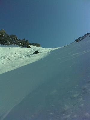
Umkehr auf Westgrat (Skidepot). Perfekte Verhältnisse, Neuschnee (Pulver) ca. 15 - 30 cm, ab 2000 m (Alp Laschadura) weicher Firn. Aufstieg via Sommerweg durch Wald bei Busshaltestelle Laschadura bis Alp.
Zahlreiche massive Nassschneelawinen an Südhängen (siehe Fotos)
Verhältnis Bilder
Letzte Änderung: 09.03.2012, 17:16Aufrufe: 4334 mal angezeigt

Aktuelle Verhältnisse in der Umgebung

Metadaten

Kartenmaterial

Kartenmaterial Umgebung
Kartenmaterial Ergänzend:

Swisstopo 1218: Zernez, M: 1:25000; Swisstopo 259S: Ofenpass, M: 1:50000; Swisstopo 459: Nationalpark, M: 1:50000; K+F 37: Nationalpark Val Mustair, M: 1:40000,Swisstopo 1218: Zernez, M: 1:25000; Swisstopo 259S: Ofenpass, M: 1:50000; Swisstopo 459: Nationalpark, M: 1:50000; K+F 37: Nationalpark Val Mustair, M: 1:40000,Swisstopo 1218: Zernez, M: 1:25000; Swisstopo 259S: Ofenpass, M: 1:50000; Swisstopo 459: Nationalpark, M: 1:50000; K+F 37: Nationalpark Val Mustair, M: 1:40000,Swisstopo 1218: Zernez, M: 1:25000; Swisstopo 259S: Ofenpass, M: 1:50000; Swisstopo 459: Nationalpark, M: 1:50000; K+F 37: Nationalpark Val Mustair, M: 1:40000,Swisstopo 1218: Zernez, M: 1:25000; Swisstopo 259S: Ofenpass, M: 1:50000; Swisstopo 459: Nationalpark, M: 1:50000; K+F 37: Nationalpark Val Mustair, M: 1:40000

Lawinenrisiko-Indikator (Prognose)

Wettervorhersage

Lawinenprognose

Webcams

Piz Laschadurella (3046m)

Von Prada Laschadura

Karte